High-level aerial photograph courtesy of Dr. Ben Stout.
[ View a low-level aerial photograph ]
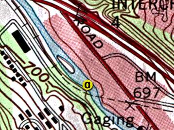
Lower Wheeling Creek Site A
12.0 kilometers upstream of the Ohio River at Elm Grove, WV

High-level aerial photograph courtesy of Dr. Ben Stout.
[ View a low-level aerial photograph ]

Topographic map reprinted, by permission, from the U.S. Geological Survey, Reston,
VA
HTML code by Chris Kreger
Maintained by ETE Team
Last updated November 10, 2004
Some images © 2004 www.clipart.com
Privacy Statement and Copyright © 1997-2004 by Wheeling Jesuit University/NASA-supported Classroom of the Future. All rights reserved.
Center for Educational Technologies, Circuit Board/Apple graphic logo, and COTF Classroom of the Future logo are registered trademarks of Wheeling Jesuit University.